Native Plants for Southern Ontario: Ecozone, Municipality, and Hardiness
Move from a southern Ontario municipality to ecological and plant-record sources without treating a map unit or hardiness zone as a local plant list.
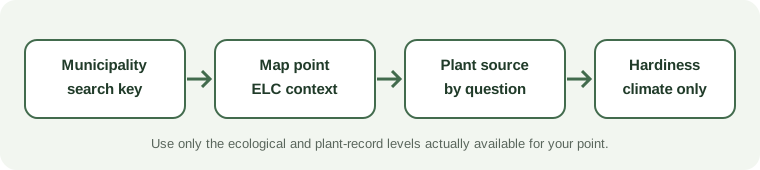
A municipality or regional municipality helps you describe where you are searching, but its boundary is administrative. It does not define one ecological setting or one complete native-plant list. Use a current map or data layer for the actual point before attaching an ecological label to a property.
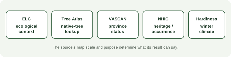
Ontario’s Ecological Land Classification describes six levels, from ecozone through ecoelement. The levels represent different scales and uses, and their mapped availability is not uniform. Ontario’s current guidance notes that ecosections have not been developed or used in the province; do not assume that every level is available as a homeowner lookup. An ecological unit can help describe landscape context, but it is not a species occurrence result.
Choose a plant source by the question. The Tree Atlas is specifically useful for native trees. VASCAN supports taxon identification and province-level status, not a municipality-wide flora. Ontario’s natural heritage information serves conservation and occurrence questions; coverage and spatial precision vary, and a blank result is not proof that a plant is absent.
Canadian hardiness is another separate layer. The Government of Canada’s current dataset listing identifies a fourth-edition hardiness resource, which describes climate conditions relevant to perennial survival. It does not establish native range, local provenance, soil moisture, or success in a particular garden bed.
For a careful lookup, record the municipality and map point, name the ecological unit and map version, verify the scientific taxon in a source suited to that plant, and note what kind of record it returns. Then inspect the garden’s light, soil, water, and space. A municipality, ecological label, provincial status, and hardiness value each answer a different part of the decision.
Sources and further reading
- Ecological Land Classificationprimary
- The Tree Atlasprimary
- VASCAN Checklistprimary
- Get Natural Heritage Informationprimary
- Plant Hardiness Zones of Canada datasetprimary