How to Read Native-Plant Range Maps and Records
Identify what kind of plant map or record you have, then read its geography, date, precision, and limits before applying it locally.
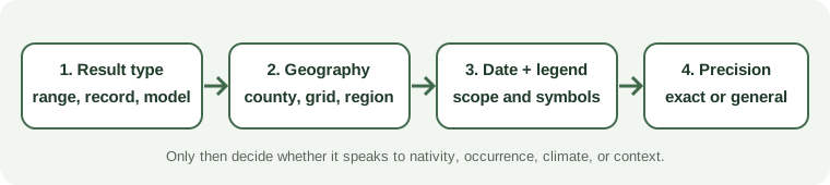
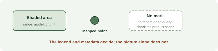
A colored map is not one kind of evidence. Before using it for a garden decision, identify what the source mapped and which place the result represents.
- A historic range or county list summarizes where a taxon was understood to occur under that source’s rules and date.
- A specimen or observation map shows documented records. Check the record date, locality, and coordinate precision; one record does not show continuous occupancy.
- A checklist may state that a taxon is native somewhere in a province or state without assigning it to every county.
- A modeled distribution predicts suitable or expected habitat under a method. It is not the same as a collected specimen.
- An ecoregion describes environmental context, while a hardiness zone describes climate relevant to winter survival. Neither is a species-range result.
- A conservation layer may emphasize rare or tracked features rather than inventorying common plants.
Read the legend and metadata before interpreting color or blank space. The Michigan Flora map guidance explains that many specimen points were retrospectively georeferenced from locality descriptions and are approximate. Fuzzy centroid symbols can stand for records without usable coordinates; sensitive rare-plant locations may be generalized, and extirpated points are historical. Its county richness page also explains that collection effort varies, so a lower total is not evidence that a plant is absent.
Check the data date and taxonomic name as well. A source can change its accepted names, map unit, or record coverage. A blank cell may mean “not listed in this table,” no searched record, or outside the product’s scope; only the source documentation can distinguish those meanings.
Use this sequence: name the result type, write down its geographic unit, inspect the legend and date, check how precise the locality is, and read what the source says about missing data. Then verify the taxon in an appropriate flora and assess the property’s conditions. A map can narrow a search, but it does not by itself establish current occupancy, native origin, or garden suitability.
Sources and further reading
- Michigan Flora Mapsprimary
- Michigan Flora County Map Completenessprimary
- About Native Plants Finderauthoritative-secondary
- Ecoregions of North Americaprimary
- Map Creation, 2023 Plant Hardiness Zone Mapprimary