Wet Garden or Wetland? An Ontario Site Check
Record water patterns and check local wetland guidance before changing drainage or vegetation in a wet Ontario area.
On this page
A low, wet corner can be an ordinary garden bed, a wetland, a wetland edge, or part of a drainage or stormwater system. Standing water and wetland plants are clues to observe, not a way to establish a boundary or determine what changes are allowed. Before filling, draining, excavating, or redirecting water, check which kind of site question you have.
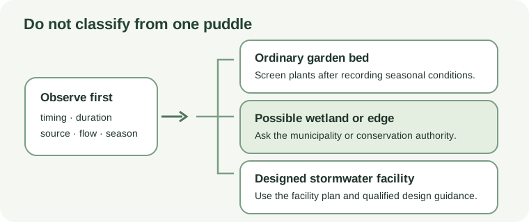
Record the water pattern without changing it
Note where water appears, how long it remains, whether it moves across the surface, and how those observations change through the year. Look for likely sources such as a downspout, slope, drain outlet, nearby pavement, or a naturally low area. Record nearby streams, ponds, wooded wet areas, or mapped natural features. Do not dig test holes or change water flow to make the site easier to classify.
Ontario describes swamps, marshes, bogs, and fens as different wetland types with different vegetation, soils, and water conditions. Some areas flood periodically; others remain wet for longer periods. A wet garden may have seasonal ponding without being a wetland, while a wetland boundary cannot be established from a single plant, puddle, or home drainage test.
Check the local evaluation path
Ontario’s Wetland Evaluation System informs land-use planning. The province says that wetlands can only be evaluated by trained evaluators and provides different manuals for different regions. Its wetland evaluation page and current manuals explain the formal process; they are not homeowner drainage tests.
Before altering a site that may be a wetland or wetland edge, contact the municipality or conservation authority for the property’s location. Ask whether mapping, a trained wetland evaluator, a permit, or another local review applies to the proposed work. The answer depends on the location and project; this page cannot classify a parcel or decide whether a change is permitted.
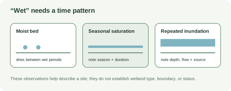
Keep gardens and designed systems distinct
An ordinary garden bed that stays moist can be assessed for plant fit using observations of shade, seasonal water, soil, and available space. The wet-shade shrub guide treats plant matching as separate from wetland status.
Engineered stormwater facilities and designed wetlands have other requirements. Ontario’s stormwater manual treats their planting as part of a designed water-management system with a drainage area, facility purpose, public-safety considerations, and planned plant community. Do not use a wetland plant list as a private-garden prescription or alter a facility based on a garden article.
If a low area appears to support a natural wetland or repeatedly receives water from beyond the bed, leaving it undisturbed may be the best next step while you seek local guidance. If local review confirms ordinary garden conditions, use the site assessment worksheet and compare candidates against the observed water pattern rather than the word “wet.”