Site Assessment Worksheet for Native Plant Selection
Record light, soil, water, roots, runoff, and site use together before screening plants for a difficult planting bed.
On this page
Use this worksheet to describe one planting area before searching for plants. Make a separate record for areas that differ in light, water, slope, soil, or use. It is an observation aid, not a diagnosis, a pass/fail test, or a substitute for local regulatory review.
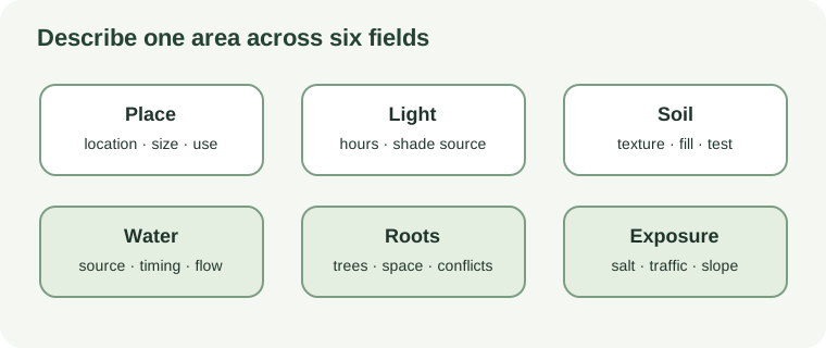
Record the area
| Field | What to note |
|---|---|
| Location and size | City or region, bed dimensions, nearby buildings, pavement, and intended use. |
| Light | Approximate hours of direct sun; whether shade comes from a tree, building, fence, or seasonal canopy. |
| Soil | Known soil-map unit or soil-test date; observed texture, surface crust, fill history, and any area that differs within the bed. |
| Water | Where water arrives and leaves, where it ponds, and what you observe after rain and during dry periods. Note the season and likely source. |
| Roots and space | Existing trees and shrubs, visible roots, trunk flare, likely rooting conflicts, and room for mature plant size. |
| Exposure and use | Road-salt spray or runoff, foot or vehicle traffic, pets, slope, wind, access, and the planting’s purpose. |
| Unknowns | Questions about contamination, utilities, drainage systems, wetland status, or local rules that need outside confirmation. |
Describe conditions without turning them into a score
Write what you saw, where you saw it, and when. “Water stood in the low corner the morning after rain” is more useful than “bad drainage.” “A hard surface appears beside the gate where people walk” is more useful than “compacted.” A field observation may suggest what to investigate, but it does not prove the cause.
Keep texture and compaction separate. Clay describes particle size and can hold water; compaction describes soil structure and pore space. Keep shade and moisture separate too: a wall can cast shade while excluding rain, and tree roots can take up water beneath a canopy. Salt spray, salty runoff, and dog urine are different exposures, and comparative dog-urine tolerance is not established for Ontario or nearby native trees, shrubs, and perennials.
Use the soil reports and field checks guide to choose among a soil map, laboratory test, or field observation. Do not dig or probe until underground utilities are located. If your notes suggest a possible wetland, contamination, unstable slope, drainage change, or engineered stormwater system, use the site-escalation guide to identify the next decision-maker.
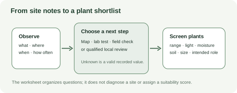
Turn the record into a shortlist
For each candidate, compare local native range, light, moisture pattern, soil needs, mature size, and intended role with the notes above. Record the source and its geographic scope. Mark claims as uncertain when the source is broad, dated, or based on a public project rather than a residential planting. Leave a field blank when it is unknown instead of guessing.
This record can guide follow-up with a local extension service, native-plant nursery, conservation authority, soil laboratory, arborist, or qualified site professional. It does not certify a planting plan or determine a property’s legal status.
Sources and further reading
- Cropland In-Field Soil Health Assessment Guideprimary
- Soil testing for lawns and gardensauthoritative-secondary
- Wetlands evaluationprimary
- Toronto’s Dog Off-Leash Strategy: A Citywide Approach to Dogs Off-Leash Areasprimary