How to Make a Site Plan for a Native Garden
Create a measured working map of a native garden's boundaries, fixed features, light, water, utilities, access, and planting phases before choosing quantities.
On this page
A site plan is a working map that helps you compare a garden idea with the property you have. It can organize measurements and questions before you choose plants or quantities. It is not a property survey, utility locate, drainage design, or engineering plan.
Draw the base map
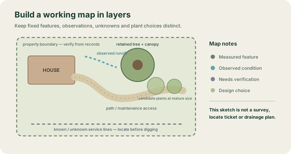
Choose a scale that lets you record the whole area and still read the details. Start with a bird’s-eye outline of the proposed bed and nearby features: buildings, paths, fences, driveways, trees, existing planting, slopes, and places where water enters or leaves. Use property records or a survey for boundaries; do not treat an estimated fence line as a legal property line.
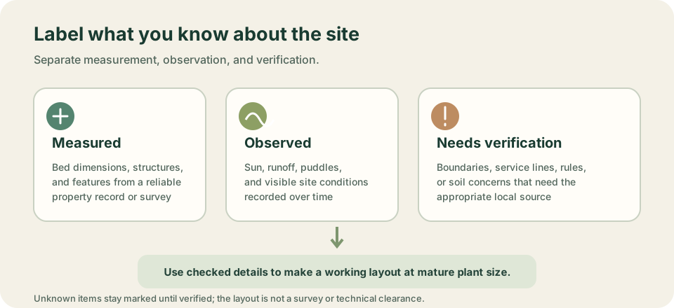
Mark which details are measured, which are observations, and which still need confirmation. Add known easements and utility information, but label uncertain lines as unknown. Before digging, contact the correct local locate service and find out whether private services need a separate check. A map can show where to ask; it cannot establish that a site is clear to excavate.
Record conditions over time
Note sunlight at different times and seasons, especially where tree canopy or a building changes the shade. After rain, record runoff paths, puddles, and areas that remain wet. Write down visible soil texture and site history, but keep these as observations rather than diagnoses. A routine fertility test does not assess every environmental contaminant; if past use or specific cues raise a concern, ask a local qualified program or professional what assessment applies. Do not order a universal test panel based on a visual cue alone.
For a shared garden, ask the people who will use it about routes, work areas, water, tools, information, and places to rest before placing beds. Applicable accessibility requirements depend on the facility and jurisdiction; do not copy recreation-route dimensions into a private yard. The Access Board’s Chapter 10 guide covers specified outdoor developed recreation facilities, not every home garden.
Turn the map into a planting layout
Add the garden’s purpose, care capacity, and any phased work. Place candidate plants on a copy of the map using verified mature height and spread, then reserve paths and maintenance access. Keep light, moisture, soil, native range, utilities, and local rules as separate checks. A hardiness zone or soil map can screen questions, but neither proves fit at the bed.
Check applicable association documents and current local rules before finalizing the layout; approval processes and requirements depend on the property and jurisdiction. If the plan involves a wetland, shoreline, steep slope, retained tree, or uncertain drainage, pause for the relevant local authority or qualified professional before changing ground. Use the Michigan clay guide or the Ontario wet-shade spacing guide for those more specific decisions.
Sources and further reading
- 19. Landscape Designauthoritative-secondary
- Steps to Creating a Community Garden or Expand Urban Agriculture at a Brownfields Siteauthoritative-secondary
- Chapter 10: Outdoor Developed Areasprimary